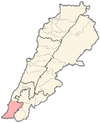
Zalloutieh
Jump to navigation
Jump to search
Zalloutieh
الزلوطية Zallutiyeh | |
|---|---|
| Coordinates: 33°06′34″N 35°14′51″E / 33.10944°N 35.24750°E | |
| Country | |
| Governorate | South Lebanon Governorate |
| District | Tyre District |
| Time zone | UTC+2 (EET) |
| • Summer (DST) | UTC+3 (EEST) |
Zalloutieh (Arabic: الزلوطية) is a local authority in Southern Lebanon, located in Tyre District, Governorate of South Lebanon. It is a Sunni Muslim village.
Name
[edit]According to E. H. Palmer, Kh. Zallûtiyeh means the ruin of pebbles.[1]
History
[edit]In 1881, the PEF's Survey of Western Palestine (SWP) found "large heaps of small stones" at Kh. Zallûtiyeh.[2]
Presently, Zalloutieh is listed as a Lebanese local authority in the Tyre District.[3]
References
[edit]Bibliography
[edit]- Conder, C.R.; Kitchener, H.H. (1881). The Survey of Western Palestine: Memoirs of the Topography, Orography, Hydrography, and Archaeology. Vol. 1. London: Committee of the Palestine Exploration Fund.
- Palmer, E.H. (1881). The Survey of Western Palestine: Arabic and English Name Lists Collected During the Survey by Lieutenants Conder and Kitchener, R. E. Transliterated and Explained by E.H. Palmer. Committee of the Palestine Exploration Fund.
External links
[edit]- Zalloutieh, Localiban
- Survey of Western Palestine, Map 3: IAA, Wikimedia commons

