Unionville, Butler County, Pennsylvania
Unionville | |
|---|---|
 Unionville  Unionville | |
| Coordinates: 40°56′29″N 79°57′43″W / 40.94139°N 79.96194°W | |
| Country | United States |
| State | Pennsylvania |
| County | Butler |
| Township | Center |
| Area | |
| • Total | 2.6 sq mi (6.7 km2) |
| • Land | 2.6 sq mi (6.7 km2) |
| • Water | 0.0 sq mi (0.0 km2) |
| Elevation | 1,283 ft (391 m) |
| Population (2010) | |
| • Total | 962 |
| • Density | 375/sq mi (144.6/km2) |
| Time zone | UTC-5 (Eastern (EST)) |
| • Summer (DST) | UTC-4 (EDT) |
| GNIS feature ID | 2633671 |
Unionville is a census-designated place[1] located in Center Township, Butler County, in the U.S. state of Pennsylvania. As of the 2010 census, the population was 962.[2]
Unionville is located in the northwestern corner of Center Township and is bordered to the southwest by the Shanor-Northvue CDP, to the north by Clay Township and to the west by Franklin Township. Pennsylvania Route 8 passes through the community, leading south 6 miles (10 km) to Butler, the county seat, and north 14 miles (23 km) to Harrisville.
Education
[edit]It is in the Butler Area School District.[3] Butler Area Intermediate High School and Butler Area Senior High School are the district's comprehensive secondary schools.
References
[edit]- ^ "2010 CENSUS - CENSUS BLOCK MAP: Center township, PA" (PDF).
- ^ "Geographic Identifiers: 2010 Demographic Profile Data (G001): Unionville CDP, Pennsylvania". U.S. Census Bureau, American Factfinder. Archived from the original on February 12, 2020. Retrieved April 2, 2014.
- ^ "2020 CENSUS - SCHOOL DISTRICT REFERENCE MAP: Butler County, PA" (PDF). U.S. Census Bureau. Archived (PDF) from the original on July 14, 2024. Retrieved July 14, 2024. - Text list Archived July 14, 2024, at the Wayback Machine
External links
[edit]Municipalities and communities of Butler County, Pennsylvania, United States | ||
|---|---|---|
| City | 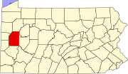 | |
| Boroughs | ||
| Townships | ||
| CDPs | ||
| Unincorporated communities | ||
| Footnotes | ‡This populated place also has portions in an adjacent county or counties | |
This Butler County, Pennsylvania state location article is a stub. You can help Wikipedia by expanding it. |