Terrace Bay Airport
Jump to navigation
Jump to search
Terrace Bay Airport | |||||||||||
|---|---|---|---|---|---|---|---|---|---|---|---|
| Summary | |||||||||||
| Airport type | |||||||||||
| Operator | |||||||||||
| Location | Terrace Bay, Ontario | ||||||||||
| Time zone | EST (UTC−05:00) | ||||||||||
| • Summer (DST) | EDT (UTC−04:00) | ||||||||||
| Elevation AMSL | 950 ft / 290 m | ||||||||||
| Coordinates | 48°48′48″N 087°05′58″W / 48.81333°N 87.09944°W | ||||||||||
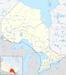
| Map | |||||||||||
| Runways | |||||||||||
| |||||||||||
Source: Canada Flight Supplement[1] | |||||||||||
Terrace Bay Airport (IATA: YTJ, ICAO: CYTJ) is an abandoned airport that was located 2.0 nautical miles (3.7 km; 2.3 mi) north of Terrace Bay, Ontario, Canada.
Terrace Bay Council voted in 2005 to close the airport's runway, saving the community roughly $40,000 a year. Ministry of Natural Resources, Hydro and emergency helicopters will still have access to the facility year round.
References
[edit]External links
[edit]- Terrace Bay Airport on COPA's Places to Fly airport directory
- Accident history for YTJ: Terrace Bay Airport at Aviation Safety Network
- Past three hours METARs, SPECI and current TAFs for Terrace Bay Airport from Nav Canada as available.
