Short North Historic District
Jump to navigation
Jump to search
Short North Historic District | |
 The Yukon Building | |
 Interactive map | |
| Location | N. High St. roughly between Poplar St. and Cedar Ave., Columbus, Ohio |
|---|---|
| Coordinates | 39°58′34″N 83°00′12″W / 39.976111°N 83.003333°W |
| NRHP reference No. | 90000583[1] |
| Added to NRHP | April 19, 1990 |
The Short North Historic District is a historic district in The Short North neighborhood of Columbus, Ohio. The district was listed on the National Register of Historic Places in 1990.[1][2]
Gallery
[edit]-
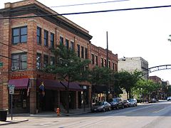 McKinley Building and 691 N. High
 -
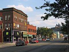 Joyce and Wallenheimer Building
 -
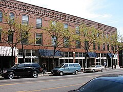 Lincoln and Maurice Buildings


See also
[edit]References
[edit]- ^ a b "National Register Information System". National Register of Historic Places. National Park Service. March 13, 2009.
- ^ "National Register of Historic Places Registration Form". National Park Service. Retrieved January 8, 2021.

This Columbus, Ohio-related article is a stub. You can help Wikipedia by expanding it. |