Palaichori Morphou
Jump to navigation
Jump to search
Palaichori Morphou
Παλαιχώρι Μόρφου | |
|---|---|
 | |
| Coordinates: 34°55′25″N 33°05′28″E / 34.92361°N 33.09111°E | |
| Country | |
| District | Nicosia District |
| Elevation | 2,251 ft (686 m) |
| Population (2001)[1] | |
| • Total | 1,196 |
| Time zone | UTC+2 (EET) |
| • Summer (DST) | UTC+3 (EEST) |
| Website | www |
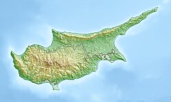
Palaichori Morphou (Greek: Παλαιχώρι Μόρφου) is a village located in the Nicosia District of Cyprus on the E 903 road. The village stands at an altitude of 930 m.[2] Palaichori Morphou is separated from Palaichori Oreinis by the Serrache River.[2]
References
[edit]External links
[edit]- Official website (in Greek and English)
- palaichori.com Guide to the Village of Palaichori (in English)

