Mpofu
Jump to navigation
Jump to search
Mpofu | |
|---|---|
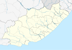
| Coordinates: 32°20′24″S 26°47′31″E / 32.340°S 26.792°E | |
| Country | South Africa |
| Province | Eastern Cape |
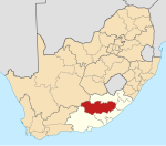
| District | Chris Hani |
| Municipality | Enoch Mgijima |
| Area | |
| • Total | 1.73 km2 (0.67 sq mi) |
| Population (2001)[1] | |
| • Total | 171 |
| • Density | 99/km2 (260/sq mi) |
| Time zone | UTC+2 (SAST) |
Mpofu is a town in Chris Hani District Municipality in the Eastern Cape province of South Africa.
As of 1996, it was the seat of a magisterial district.[2]
References
[edit]- ^ a b "Sub Place Mpofu". Census 2001.
- ^ "Magisterial District List". Statistics South Africa. Archived from the original on 24 August 2007. Retrieved 18 August 2013.


