Missouri Heights School
Jump to navigation
Jump to search
Missouri Heights School | |
 | |
| Nearest city | Carbondale, Colorado |
|---|---|
| Coordinates | 39°25′56″N 107°08′14″W / 39.43222°N 107.13722°W |
| Area | less than one acre |
| Built | 1917 |
| MPS | Rural School Buildings in Colorado MPS |
| NRHP reference No. | 99001145[1] |
| Added to NRHP | September 23, 1999 |
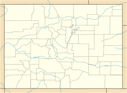
The Missouri Heights School, in Garfield County, Colorado near Carbondale, Colorado, was listed on the National Register of Historic Places in 1999.[1]
The 26 by 44 feet (7.9 m × 13.4 m) school was built in 1917. It is located at an elevation of 6,950 feet (2,120 m) "in a rolling open alpine plateau area known since the late 1800s as Missouri Heights. Surrounded by cattle range and scrubland thick with sagebrush, the Missouri Heights School property includes a school building, a teacherage, two outhouses and a coal shed."[2]
It is located on County Road 102, 0.5 miles (0.80 km) east of its junction with County Road 100, and is about 4 miles (6.4 km) northeast of the town of Carbondale.[2]
References
[edit]- ^ a b "National Register Information System". National Register of Historic Places. National Park Service. November 2, 2013.
- ^ a b Ron Sladek; Willa Soncarty (May 21, 1999). "National Register of Historic Places Registration: Missouri Heights School / 5GF.2735". National Park Service. Retrieved April 14, 2019. With accompanying 21 photos
