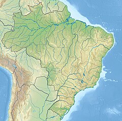
Macauã River
Jump to navigation
Jump to search
| Macauã River | |
|---|---|
| Native name | Rio Macauã (Portuguese) |
| Location | |
| Country | Brazil |
| Physical characteristics | |
| Source | |
| • location | Acre state |
| Mouth | |
• location | Iaco River, Sena Madureira, Acre |
• coordinates | 9°11′16″S 68°43′05″W / 9.187644°S 68.717920°W |
| Basin features | |
| River system | Iaco River |
Macauã River is a river of Acre state in western Brazil, a tributary of the Iaco River.
The river forms most of the southeast boundary of the 176,349 hectares (435,770 acres) Macauã National Forest, a sustainable use conservation unit created in 1988.[1] It flows through the northern part of the 21,148 hectares (52,260 acres) São Francisco National Forest, a sustainable use conservation unit created in 2001.[2] It then flows through the eastern part of the 750,795 hectares (1,855,250 acres) Cazumbá-Iracema Extractive Reserve, established in 2002 to support sustainable use of the natural resources by the traditional population.[3]
See also
[edit]References
[edit]- ^ FLONA do Macauã (in Portuguese), ISA: Instituto Socioambiental, retrieved 2016-06-19
- ^ FLONA de São Francisco (in Portuguese), ISA:Instituto Socioambiental, retrieved 2016-06-21
- ^ RESEX do Cazumbá-Iracema (in Portuguese), ISA: Instituto Socioambiental, retrieved 2016-06-16
