Lillian Wald Houses
Jump to navigation
Jump to search
Lillian Wald Houses | |
|---|---|
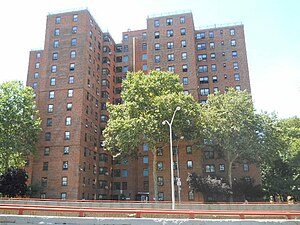
 Wald Houses in 2011 | |
 Location in New York City | |
| Coordinates: 40°43′19″N 73°58′37″W / 40.722°N 73.977°W | |
| Country | United States |
| State | New York |
| City | New York City |
| Borough | Manhattan |
| Area | |
| • Total | 0.026 sq mi (0.07 km2) |
| Population | |
| • Total | 3,757 [1] |
| ZIP codes | 10002, 10009 |
| Area code(s) | 212, 332, 646, and 917 |
The Lillian Wald Houses are a NYCHA housing project on the Lower East Side of Manhattan that honors the housing advocate of the same name.[2][3] The cornerstone was laid on East Sixth Street and Avenue D in 1947 following a change in state financing laws for which Lillian Wald campaigned.[4]
Construction of the Houses led to the end of Manhattan Street, previously a shortcut between East Third and East Houston Streets.[5]
References
[edit]- ^ a b "NYCHA Development Data Book 2023" (PDF). NYCHA. p. 55. Retrieved October 14, 2023.
- ^ Biles, Roger (2002). The Human Tradition in Urban America. Rowman & Littlefield. p. 117. ISBN 978-0-8420-2993-3.
- ^ Rogow, Sally (1966). Lillian Wald: The Nurse in Blue. Jewish Publication Society of America. p. 133.
- ^ Feld, Marjorie N. (2008). Lillian Wald: A Biography. UNC Press Books. p. 188. ISBN 978-0-8078-3236-3.
- ^ "The remains of two streets no longer on the map". Ephemeral New York. October 6, 2014. Retrieved March 8, 2022.