Lightning Ridge Airport
Jump to navigation
Jump to search
Lightning Ridge Airport | |||||||||||||||
|---|---|---|---|---|---|---|---|---|---|---|---|---|---|---|---|
| Summary | |||||||||||||||
| Airport type | Public | ||||||||||||||
| Operator | Walgett Shire Council | ||||||||||||||
| Location | Lightning Ridge, New South Wales, Australia | ||||||||||||||
| Elevation AMSL | 540 ft / 165 m | ||||||||||||||
| Coordinates | 29°27′24″S 147°59′06″E / 29.45667°S 147.98500°E | ||||||||||||||
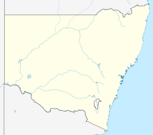
| Map | |||||||||||||||
| Runways | |||||||||||||||
| |||||||||||||||
Lightning Ridge Airport (IATA: LHG, ICAO: YLRD) is an airport located 2 nautical miles (3.7 km; 2.3 mi) south southwest[1] of Lightning Ridge, New South Wales, Australia.
Airlines and destinations
[edit]| Airlines | Destinations |
|---|---|
| Air Link | Walgett[2] |
See also
[edit]References
[edit]- ^ a b YLRD – LIGHTNING RIDGE (PDF). AIP En Route Supplement from Airservices Australia, effective 13 June 2024
- ^ "AIR LINK AND FLYPELICAN BRINGING FLIGHTS BACK TO WESTERN NSW". Australian Aviation. 27 August 2019. Retrieved 20 October 2019.
External links
[edit]
