Lees Creek, Ohio

Lees Creek, also known as Centerville,[1] is an unincorporated community in central Wayne Township, Clinton County, Ohio, United States.[2] It lies at the intersection of State Route 729 with Cox Road, 6 miles (9½ km) south of Sabina and 12 miles (19 km) southeast of Wilmington, the county seat of Clinton County.[1] It lies between the headwaters of the Middle Fork of Lees Creek, to the southeast,[1] and the Anderson Fork of Caesar Creek.[3] it had a post office, with the ZIP code 45138. The Post Office closed in 2012 and the town, including East Clinton High School, now carries a Sabina mailing address.[4]
Lees Creek is home to East Clinton Middle School and East Clinton High School.[5][6]
History
[edit]Lees Creek was originally called Centerville, and under the latter name was laid out in 1816.[7] A post office called Lees Creek has been in operation since 1819.[8] The present name comes from nearby Lees Creek.[7]
Gallery
[edit]-
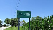 Lees Creek community sign
 -
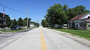 Looking north on Larrick Road in Lees Creek


References
[edit]- ^ a b c DeLorme. Ohio Atlas & Gazetteer. 7th ed. Yarmouth: DeLorme, 2004, p. 76. ISBN 0-89933-281-1.
- ^ U.S. Geological Survey Geographic Names Information System: Lees Creek, Ohio
- ^ DeLorme. Ohio Atlas & Gazetteer. 7th ed. Yarmouth: DeLorme, 2004, p. 66. ISBN 0-89933-281-1.
- ^ USPS – Cities by ZIP Code
- ^ East Clinton High School, East Clinton Local School District, 2007. Accessed 2007-09-03.
- ^ East Clinton Middle School, East Clinton Local School District, 2007. Accessed 2007-09-03.
- ^ a b Brown, Albert J. (1915). History of Clinton County, Ohio: Its People, Industries, and Institutions. B.F. Bowen. pp. 321.
- ^ "Clinton County". Jim Forte Postal History. Retrieved December 19, 2015.
Municipalities and communities of Clinton County, Ohio, United States | ||
|---|---|---|
| City |  | |
| Villages | ||
| Townships | ||
| Unincorporated communities | ||
| Ghost town | ||
| Footnotes | ‡This populated place also has portions in an adjacent county or counties | |
39°25′12″N 83°38′58″W / 39.42000°N 83.64944°W
This Clinton County, Ohio state location article is a stub. You can help Wikipedia by expanding it. |