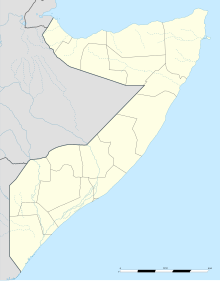
Las Anod Airport
Jump to navigation
Jump to search
Las Anod International Airport | |||||||||||
|---|---|---|---|---|---|---|---|---|---|---|---|
| Summary | |||||||||||
| Airport type | Public | ||||||||||
| Owner | Somali Civil Aviation Authority | ||||||||||
| Serves | Las Anod, Somalia | ||||||||||
| Location | Tifafleh | ||||||||||
| Elevation AMSL | 2,077 ft / 633 m | ||||||||||
| Coordinates | 8°34′00″N 47°20′35″E / 8.56667°N 47.34306°E | ||||||||||
| Map | |||||||||||
| Runways | |||||||||||
| |||||||||||
Las Anod International Airport (ICAO: HCMP) is an airstrip northwest of the city of Las Anod, the capital of SSC-Khaatumo and Sool region in Somalia.
History
[edit]In the 2010s, controversies have occurred at Las Anod airport, including over the importation of Khat, a leaf stimulant,[3] and fighting between Dhulbahante subclans.[4]
Location
[edit]The airport is located at the outskirts of the city of Las Anod, roughly 10 kilometres (6.2 mi) in a northwesterly direction in the locality of Tifafleh.[5]
See also
[edit]References
[edit]- ^ Airport information for HCMP at Great Circle Mapper.
- ^ Google Maps - Las Anod
- ^ Wmuturi, Willy Muturi. "Factors influencing khat consumption among youth in Garowe District, Puntland, Somalia".
- ^ "A Plane Carrying Medical Supplies Barred from Landing in las Anod".
- ^ Schueller, Marie-Luise, and Michael Walls. "Report by International Observers on the 2016 Voter Registration Process in Somaliland." Progressio (2017).
External links
[edit]
