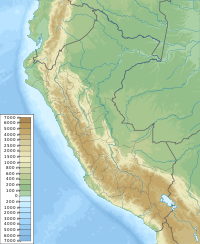
Kuntur Wachanan (Lima)
Jump to navigation
Jump to search
| Kuntur Wachanan | |
|---|---|
| Highest point | |
| Elevation | 4,800 m (15,700 ft)[1] |
| Coordinates | 12°05′33″S 75°47′21″W / 12.09250°S 75.78917°W |
| Geography | |
| Location | Peru, Lima Region |
| Parent range | Andes, Cordillera Central |
Kuntur Wachanan (Quechua kuntur condor, wacha birth, to give birth, -na a suffix,[2] 'where the condor is born', -n a suffix, also spelled Cóndorhuachanan) is a mountain in the Cordillera Central in the Andes of Peru which reaches a height of approximately 4,800 metres (15,748 ft). It is located in the Lima Region, Yauyos Province, Huancaya District.[1]
References
[edit]- ^ a b escale.minedu.gob.pe - UGEL map of the Yauyos Province (Lima Region)
- ^ Teofilo Laime Ajacopa (2007). Diccionario Bilingüe: Iskay simipi yuyayk’anch: Quechua – Castellano / Castellano – Quechua (PDF). La Paz, Bolivia: futatraw.ourproject.org.
