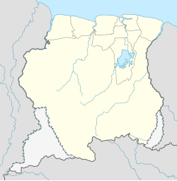
Jaw Jaw
Jaw Jaw | |
|---|---|
Village | |
| Coordinates: 4°25′31″N 55°22′22″W / 4.42528°N 55.37278°W | |
| Country | |
| District | Sipaliwini District |
| Resort | Boven Suriname |
| Population | |
| • Total | ca. 400 |
Jaw Jaw, also Yaw Yaw,[2] is a village of Saamaka Maroons[3] in the Boven Suriname resort of the Sipaliwini District of Suriname. The village is located on the Suriname River.[4]
Jaw Jaw is a transmigration village built for the inhabitants of Lombé[5] which was flooded by the Brokopondo Reservoir after the construction of the Afobaka Dam.[6] The village was built in 1964[5] on a site which had been previously used for coconut production.[7] Some of the original inhabitants of Lombé founded Nieuw Lombé near Berg en Dal.[8] Originally the village was home to 700 people,[2] but in 1976, the population was estimated at several hundred,[9] because many inhabitants had left for the city.[10]
The village has a school, a clinic, and a Roman Catholic church.[3] There is an ecotourism resort on Isadou, an island in the Suriname River across from the village.[11][4]
References
[edit]- ^ "Omgeving - Isadou - Suriname". Isadou (in Dutch). Retrieved 4 July 2020.
- ^ a b Kempen 2002, p. 113.
- ^ a b Plan Bureau 2014, p. 173.
- ^ a b Plan Bureau 2014, p. 192.
- ^ a b Kempen 2002, p. 114.
- ^ Bijl & Eerenstein 1976, p. 6.
- ^ Kempen 2002, p. 115.
- ^ "Lombe". Parbode (in Dutch). 2 June 2010. Retrieved 4 July 2020.
- ^ Bijl & Eerenstein 1976, p. 8.
- ^ Kempen 2002, p. 116.
- ^ "Jaw Jaw Isadou". Suriname Tour (in Dutch). Retrieved 4 July 2020.
Bibliography
[edit]- Bijl, H. van der; Eerenstein, J.H.W. (1976). "DE TRADITIONELE LANDBOUW VAN DE BOSLANDCREOLEN IN HET DISTRICT BROKOPONDO". Wageningen University and Research (in Dutch).
- Kempen, Michiel van (2002). Een geschiedenis van de Surinaamse literatuur. Deel 2 (in Dutch). Paramaribo: Okopipi. ISBN 9991464069. Retrieved 4 July 2020.
{{cite book}}:|website=ignored (help) - Plan Bureau (2014). "Planning Office Suriname - Districts 2009-2013" (PDF). Planning Office Suriname (in Dutch).
