Hohenzollern (mountain)
Jump to navigation
Jump to search
You can help expand this article with text translated from the corresponding article in German. (June 2010) Click [show] for important translation instructions.
|
| Hohenzollern | |
|---|---|
 View of Hohenzollern from the southwest, with Castle Hohenzollern visible on the mountain's summit | |
| Highest point | |
| Elevation | 855 m (2,805 ft) |
| Coordinates | 48°19′23″N 8°58′4″E / 48.32306°N 8.96778°E |
| Geography | |
| Parent range | Swabian Jura |
| Climbing | |
| Easiest route | Road to parking lot near summit, then stairs to the castle |

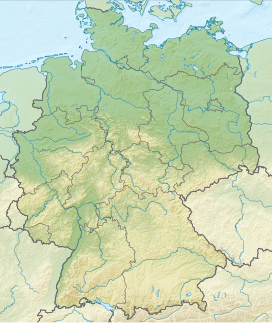
Hohenzollern is a mountain, 855 m (2,805 ft), of Baden-Württemberg, Germany. It is located in Zollernalbkreis. Hohenzollern Castle is located on its top. The mountain is an outlier, about 1 km (0.62 mi) north of the Swabian Jura.
