Hawks Nest Airport
Jump to navigation
Jump to search
Hawk's Nest Creek Airport | |||||||||||
|---|---|---|---|---|---|---|---|---|---|---|---|
| Summary | |||||||||||
| Airport type | Public | ||||||||||
| Serves | Hawk's Nest Creek | ||||||||||
| Location | Bahamas | ||||||||||
| Elevation AMSL | 3 ft / 1 m | ||||||||||
| Coordinates | 24°9′15.1″N 75°31′13.0″W / 24.154194°N 75.520278°W | ||||||||||
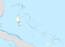
| Map | |||||||||||
| Runways | |||||||||||
| |||||||||||
Hawk's Nest Creek Airport (ICAO: MYCH) is a public use airport located near Hawk's Nest Creek, The Bahamas.
See also
[edit]References
[edit]- ^ Airport record for Hawk's Nest Creek Airport at Landings.com. Retrieved 2013-08-08
- ^ Google (2013-08-08). "location of Hawk's Nest Creek Airport" (Map). Google Maps. Google. Retrieved 2013-08-08.
External links
[edit]- Airport record for Hawk's Nest Creek Airport at Landings.com
