Grobla, Lower Silesian Voivodeship
Jump to navigation
Jump to search
Grobla | |
|---|---|
Village | |
 Church in Grobla | |
 Grobla Location of Grobla, Lower Silesian Voivodeship | |
| Coordinates: 50°59′01″N 16°07′01″E / 50.98361°N 16.11694°E | |
| Country | |
| Voivodeship | Lower Silesian |
| Powiat | Jawor |
| Gmina | Paszowice |
Grobla [ˈɡrɔbla] is a village in the administrative district of Gmina Paszowice, within Jawor County, Lower Silesian Voivodeship, in south-western Poland.[1] Prior to 1945 it was in Germany.
It lies approximately 9 km (6 mi) south-west of Jawor, and 67 km (42 mi) west of the regional capital Wrocław.
Gallery
[edit]-
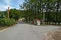 Square
 -
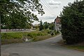 Stream
 -
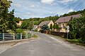 Houses by the road


References
[edit]Wikimedia Commons has media related to Grobla, Lower Silesian Voivodeship.
This Jawor County location article is a stub. You can help Wikipedia by expanding it. |