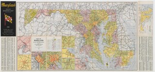
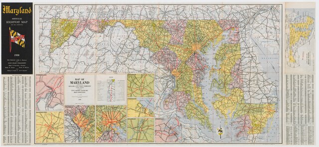
File:Maryland State Highway Map - 1950.pdf
Jump to navigation
Jump to search
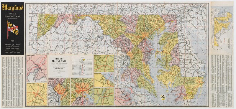
Size of this JPG preview of this PDF file: 800 × 370 pixels. Other resolutions: 320 × 148 pixels | 640 × 296 pixels | 1,024 × 474 pixels | 1,280 × 592 pixels | 2,560 × 1,184 pixels | 6,085 × 2,814 pixels.
Original file (6,085 × 2,814 pixels, file size: 13.09 MB, MIME type: application/pdf, 2 pages)
| This is a file from the Wikimedia Commons. Information from its description page there is shown below. Commons is a freely licensed media file repository. You can help. |
Summary
| Description |
English: This PDF document is a scanned 1950 road map of the state of Maryland. |
| Date | |
| Source | Maryland State Roads Commission |
| Author | Maryland State Highway Administration |
| Permission (Reusing this file) |
I was informed by a member of the Office of Communications of the Maryland State Highway Administration that this map is in the public domain and may be redistributed. |
Licensing

|
The copyright holder of this work allows anyone to use it for any purpose including unrestricted redistribution, commercial use, and modification.
Usage notes:
|
File history
Click on a date/time to view the file as it appeared at that time.
| Date/Time | Thumbnail | Dimensions | User | Comment | |
|---|---|---|---|---|---|
| current | 01:32, 15 December 2009 | 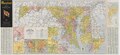 | 6,085 × 2,814, 2 pages (13.09 MB) | Viridiscalculus | (({{Information |Description={{en|1=This PDF document is a scanned 1950 road map of the state of Maryland.}} |Source=Maryland State Roads Commission |Author=Maryland State Highway Administration |Date=1950-01-01 |Permission=I was informed by a member of t |
File usage
No pages on the English Wikipedia use this file (pages on other projects are not listed).