File:Germany River Aa Map.svg
Jump to navigation
Jump to search

Size of this PNG preview of this SVG file: 614 × 600 pixels. Other resolutions: 246 × 240 pixels | 491 × 480 pixels | 786 × 768 pixels | 1,048 × 1,024 pixels | 2,096 × 2,048 pixels | 869 × 849 pixels.
Original file (SVG file, nominally 869 × 849 pixels, file size: 4.51 MB)
| This is a file from the Wikimedia Commons. Information from its description page there is shown below. Commons is a freely licensed media file repository. You can help. |
Summary

| Description |
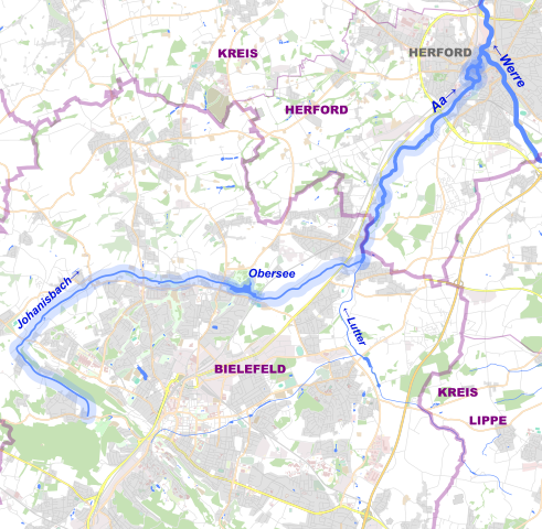
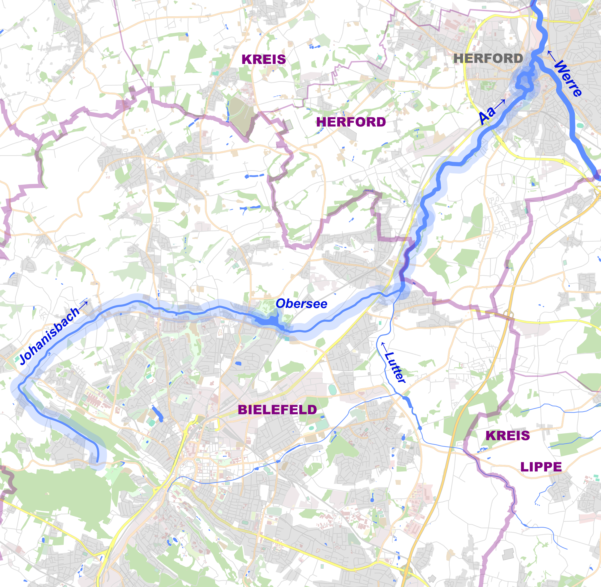
Deutsch: Verlauf des Flusses Aa zwischen Bielefeld und Herford. |
| Date | |
| Source |
Own work This W3C-unspecified vector image was created with Adobe Illustrator.
|
| Author |
TUBS |
| Object location | | View this and other nearby images on: OpenStreetMap |
|---|
Licensing
TUBS, the copyright holder of this work, hereby publishes it under the following license:
This file is licensed under the Creative Commons Attribution-Share Alike 2.0 Generic license.
Attribution: TUBS
- You are free:
- to share – to copy, distribute and transmit the work
- to remix – to adapt the work
- Under the following conditions:
- attribution – You must give appropriate credit, provide a link to the license, and indicate if changes were made. You may do so in any reasonable manner, but not in any way that suggests the licensor endorses you or your use.
- share alike – If you remix, transform, or build upon the material, you must distribute your contributions under the same or compatible license as the original.

|
I'd greatly appreciate, that you attribute this media file to Wikimedia Commons, if used outside Wikipedia or Commons. For use in publications such as books, newspapers, blogs, websites, please insert here the following line:
|
File history
Click on a date/time to view the file as it appeared at that time.
| Date/Time | Thumbnail | Dimensions | User | Comment | |
|---|---|---|---|---|---|
| current | 20:58, 26 August 2009 | | 869 × 849 (4.51 MB) | TUBS | -true type |
| 20:53, 26 August 2009 |  | 869 × 849 (4.47 MB) | TUBS | {{Information |Description= {{de|Verlauf des Flusses Aa zwischen Bielefeld und Herford.}} |Source= {{own}} {{Adobe Illustrator}} *based on Open Street Map |Date=2009-08 |Author={{TUBS}} |Permission= |other_versions= }} {{OWL}} == {{int: |
File usage
The following pages on the English Wikipedia use this file (pages on other projects are not listed):
Global file usage
The following other wikis use this file:
- Usage on de.wikipedia.org
- Usage on fa.wikipedia.org
- Usage on fr.wikipedia.org
- Usage on hr.wikipedia.org
- Usage on www.wikidata.org