Eldred, Kansas
Jump to navigation
Jump to search
Eldred, Kansas | |
|---|---|
 | |
 Eldred  Eldred | |
| Coordinates: 37°03′02″N 98°46′04″W / 37.05056°N 98.76778°W[1] | |
| Country | United States |
| State | Kansas |
| County | Barber |
| Elevation | 1,667 ft (508 m) |
| Time zone | UTC-6 (CST) |
| • Summer (DST) | UTC-5 (CDT) |
| Area code | 620 |
| FIPS code | 20-20110 [1] |
| GNIS ID | 484525 [1] |
Eldred is an unincorporated community in Barber County, Kansas, United States.[1] It is 7 miles (11 km) northwest of Hardtner.
History
[edit]The post office in Eldred was discontinued in 1908.[2]
References
[edit]- ^ a b c d e "Eldred, Kansas", Geographic Names Information System, United States Geological Survey, United States Department of the Interior
- ^ "Kansas Post Offices, 1828-1961". Kansas Historical Society. Archived from the original on October 9, 2013. Retrieved June 18, 2014.
Further reading
[edit]External links
[edit]Municipalities and communities of Barber County, Kansas, United States | ||
|---|---|---|
| Cities | 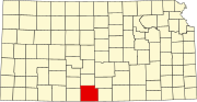 | |
| CDP | ||
| Unincorporated communities | ||
| Townships | ||
This article about a location in Barber County, Kansas is a stub. You can help Wikipedia by expanding it. |