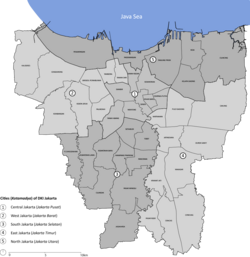
Duri Kosambi, Cengkareng
Jump to navigation
Jump to search
An editor has nominated this article for deletion. You are welcome to participate in the deletion discussion, which will decide whether or not to retain it. |
Duri Kosambi | |
|---|---|
Location in Jakarta | |
| Coordinates: 6°10′20″S 106°43′14″E / 6.1721148°S 106.7205154°E | |
| Country | |
| Province | Jakarta |
| City | West Jakarta |
| District | Cengkareng |
| Area | |
| • Total | 5.91 km2 (2.28 sq mi) |
| Population (2023) | |
| • Total | 103,836 |
| • Density | 18,000/km2 (46,000/sq mi) |
| Postal code | |
Duri Kosambi is an administrative village (kelurahan) in the Cengkareng district of Indonesia. It has postal code of 11750.
Etymology
[edit]The area received its name from a plantation of Macassar oil-producing Schleichera oleosa trees, known locally as Kosambi, which used to occupy the area. The trees were known to be thorny, hence the term Duri ("thorn" in Indonesian).[1]
Demographics and geography
[edit]Statistics Indonesia estimated the administrative village's population in 2023 as 103,836.[2] It covers an area of 5.91 square kilometres (2.28 sq mi), and borders the district of Kalideres in Tangerang to its south.[3]
References
[edit]- ^ Abdullah, Nurudin (20 September 2016). "JAKARTA TEMPO DOELOE: Inilah Asal Usul Nama Duri Kosambi Jakarta Barat". Bisnis.com (in Indonesian). Retrieved 22 July 2024.
- ^ "Jumlah Penduduk menurut Kelurahan dan Jenis Kelamin (Jiwa), 2019-2023" (in Indonesian). Statistics Indonesia. Retrieved 22 July 2024.
- ^ "Kecamatan Cengkareng Dalam Angka 2023" (in Indonesian). Statistics Indonesia. 26 September 2023. Retrieved 22 July 2024.
