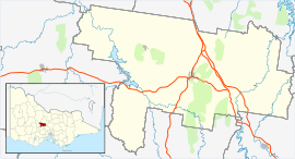
Bradford, Victoria
Jump to navigation
Jump to search
This article needs additional citations for verification. (March 2014) |
| Bradford Victoria | |||||||||||||||
|---|---|---|---|---|---|---|---|---|---|---|---|---|---|---|---|
| Coordinates | 36°55′07″S 144°04′04″E / 36.918528°S 144.067643°E | ||||||||||||||
| Population | 9 (2016 census)[1] | ||||||||||||||
| Postcode(s) | 3463 | ||||||||||||||
| LGA(s) | Shire of Mount Alexander | ||||||||||||||
| State electorate(s) | Bendigo West | ||||||||||||||
| Federal division(s) | Murray | ||||||||||||||
| |||||||||||||||
Bradford is a locality in the Shire of Mount Alexander, Victoria.
History
[edit]A railway station known as Pollard once served the town with passenger and goods trains. The last service ran on 15 January 1969.
References
[edit]- ^ Australian Bureau of Statistics (27 June 2017). "Bradford (State Suburb)". 2016 Census QuickStats. Retrieved 18 March 2018.
External links
[edit]
