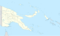
Bogia District
Jump to navigation
Jump to search
Bogia District | |
|---|---|
| Coordinates: 4°16′37″S 144°58′05″E / 4.2770°S 144.9680°E | |
| Country | Papua New Guinea |
| Province | Madang Province |
| Capital | Bogia |
| Area | |
| • Total | 3,978 km2 (1,536 sq mi) |
| Population (2011 census) | |
| • Total | 75,067 |
| • Density | 19/km2 (49/sq mi) |
| Time zone | UTC+10 (AEST) |
Bogia District is a district in the north-west of Madang Province in Papua New Guinea. It is one of the six administrative districts that make up the province.
Almami Rural LLG is one of the three local-level government council areas of Bogia district in Madang Province. It comprises over thirty council ward areas.
References
[edit]
4°16′37″S 144°58′05″E / 4.277010°S 144.968022°E
