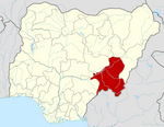
Bali, Nigeria
Jump to navigation
Jump to search
This article needs additional citations for verification. (February 2020) |
Bali, Nigeria
Bakundi Bakundi | |
|---|---|
LGA and town | |
| Coordinates: 7°51′07″N 10°57′49″E / 7.8519°N 10.9636°E | |
| Country | |
| State | TARABA STATE |
| Local Government Headquarters | Bali |
| Bakundi | 1860 |
| Government | |
| • Local Government Chairman and the Head of the Local Government Council | HON.MICAH DANBABA DAKKA |
| Time zone | UTC+1 (WAT) |
| Climate | Aw |
 | |
Bali is a Local Government Area in Taraba State, Nigeria.
The postal code of the area is 672.[1]
Education
[edit]References
[edit]- ^ "Post Offices- with map of LGA". NIPOST. Archived from the original on 7 October 2009. Retrieved 20 October 2009.

