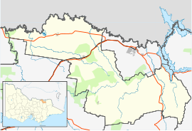
Allans Flat, Victoria
Jump to navigation
Jump to search
| Allans Flat Victoria | |
|---|---|
| Coordinates | 36°16′S 146°54′E / 36.267°S 146.900°E |
| Population | 318 (2016 census)[1] |
| Postcode(s) | 3691 |
| LGA(s) | Shire of Indigo |
| State electorate(s) | Benambra |
| Federal division(s) | Indi |
Allans Flat is a small town in Victoria, Australia. It is located along Osbornes Flat Road, north-east of Yackandandah. The areas around the town were mined for gold between the 1850s and 1904 though without sufficient population for a Post Office until 26 October 1876.[2]
The town was surveyed and proclaimed in 1905. The Post Office closed in 1975.[2]
References
[edit]- ^ Australian Bureau of Statistics (27 June 2017). "Allans Flat (State Suburb)". 2016 Census QuickStats. Retrieved 24 August 2020.
- ^ a b Premier Postal History, Post Office List, retrieved 11 April 2008

