Ancient and Primeval Beech Forests of the Carpathians and Other Regions of Europe: Difference between revisions
→top: Poland is not included in the UNESCO site |
ILoveCaracas (talk | contribs) Expanded and completed (translated from the Spanish Wikipedia) |
||
| Line 47: | Line 47: | ||
| footnotes = {{Infobox World Heritage Site|child=yes}} |
| footnotes = {{Infobox World Heritage Site|child=yes}} |
||
}} |
}} |
||
[[File:Beech-whc.jpg|thumb|300px|Location of massifs]] |
|||
'''Primeval Beech Forests of the Carpathians and Other Regions of Europe''' is a transnational composite nature site, encompassing forests in 12 countries of Europe. The Primeval Beech Forests of the Carpathians include ten separate massifs located along the {{convert|185|km|mi|abbr=on}} long axis from the [[Rakhiv]] mountains and [[Chornohora]] ridge in [[Ukraine]] over the Poloniny Ridge (Slovakia) to the [[Vihorlat Mountains]] in [[Slovakia]]. The Ancient Beech Forests of Germany include five locations in various parts of Germany. |
'''Primeval Beech Forests of the Carpathians and Other Regions of Europe''' is a transnational composite nature site, encompassing forests in 12 countries of Europe. The Primeval Beech Forests of the Carpathians include ten separate massifs located along the {{convert|185|km|mi|abbr=on}} long axis from the [[Rakhiv]] mountains and [[Chornohora]] ridge in [[Ukraine]] over the Poloniny Ridge (Slovakia) to the [[Vihorlat Mountains]] in [[Slovakia]]. The Ancient Beech Forests of Germany include five locations in various parts of Germany. |
||
| Line 60: | Line 59: | ||
{| class="wikitable" |
{| class="wikitable" |
||
|- |
|- |
||
! |
! Protected site !! Type of natural reserve !! Region !! Country !! Protected area !! Area of respect |
||
|- |
|- |
||
| |
| [[Stužica]] – Bukovské vrchy || [[Poloniny National Park]] || [[Prešov Region|Prešov]] || [[Slovakia]] || 2950 ha || 11300 ha |
||
|- |
|- |
||
| |
| [[Rožok]] || Preserved areas of Prešov || [[Prešov Region|Prešov]] || [[Slovakia]] || 67,1 ha || 41,4 ha |
||
|- |
|- |
||
| |
| [[Vihorlat]] || Preserved areas of Prešov || [[Prešov Region|Prešov]] || [[Slovakia]] || 2578 ha || 2413 ha |
||
|- |
|- |
||
| [[Havešová]] || Preserved areas of Prešov || [[Prešov Region|Prešov]] || [[Slovakia]] || 171,3 ha || 63,9 ha |
|||
| 4 || Maramoros || 2243.6 [[Hectare|ha]] || 6230.4 ha |
|||
|- |
|- |
||
| [[Jasmund]] || [[Jasmund National Park]] || [[Mecklenburg-Vorpommern]] || [[Germany]] || 492,5 ha || 2510,5 ha |
|||
| 5 || Kuziy / Trybushany || 1369.6 [[Hectare|ha]] || 3163.4 ha |
|||
|- |
|- |
||
| |
| [[Serrahn Hills|Serrahn]] || [[Müritz National Park]] || [[Mecklenburg-Vorpommern]] || [[Germany]] || 268,1 ha || 2568 ha |
||
|- |
|- |
||
| [[Grumsiner Forest]] || [[Grumsiner Forest|Grumsiner Forest Nature Reserve]] || [[Brandenburg]] || [[Germany]] || 590,1 ha || 274,3 ha |
|||
| 7 || [[Stužica]] / Bukovské vrchy || rowspan="4" | [[Prešov Region|Prešov]] || [[Poloniny National Park]] ([[East Carpathian Biosphere Reserve]]) || 2950 [[Hectare|ha]] || 11300 ha |
|||
|- |
|- |
||
| |
| [[Hainich]] || [[Hainich National Park]] || [[Thuringia]] || [[Germany]] || 1573,4 ha || 4085,4 ha |
||
|- |
|- |
||
| |
| [[Kellerwald]] || [[Kellerwald-Edersee National Park]] || [[Hesse]] || [[Germany]] || 1467,1 ha || 4271,4 ha |
||
|- |
|- |
||
| [[Tejera Negra Beech]] || [[Sierra Norte de Guadalajara Natural Park]] || [[Castile-La Mancha]] || [[Spain]] || 255,52 ha || 13880,86 ha |
|||
| 10 || Havešová || 171.3 [[Hectare|ha]] || 63.9 ha |
|||
|- |
|- |
||
| [[Montejo Beech]] || [[Montejo Beechwood|Natural Site of National Interest of the Montejo de la Sierra Beech]] || [[Community of Madrid]] || [[Spain]] || 71,79 ha || 13880,86 ha |
|||
| 11 || Jasmund || rowspan=2 | [[Mecklenburg-Vorpommern]] || [[Jasmund National Park]] || 492.5 [[Hectare|ha]] || 2510.5 ha |
|||
|- |
|- |
||
| |
| [[Irati Forest|Lizardoia]] || [[Irati Forest|Integral Reserve of Lizardoia]] || [[Navarre]] || [[Spain]] || 63,97 ha || 24494,52 ha |
||
|- |
|- |
||
| [[Larra-Belagua|Aztaparreta]] || [[Larra-Belagua|Integral Reserve of the Ravine of Aztaparreta]] || [[Navarre]] || [[Spain]] || 171,06 ha || 24494,52 ha |
|||
| 13 || Grumsiner Forest || [[Brandenburg]] || Grumsiner Forest Nature Reserve || 590.1 [[Hectare|ha]] || 274.3 ha |
|||
|- |
|- |
||
| |
| [[Cuesta Fría Beech]] || [[Picos de Europa National Park]] || [[Castile and León]] || [[Spain]] || 213,65 ha || 14253 ha |
||
|- |
|- |
||
| [[Canal de Asotín]] || [[Picos de Europa National Park]] || [[Castile and León]] || [[Spain]] || 109,58 ha || 14253 ha |
|||
|- |
|- |
||
| |
| [[Nationalpark Kalkalpen]] || [[Nationalpark Kalkalpen]] || [[Upper Austria]] || [[Austria]] || 1867,45 ha || 1545,05 ha |
||
|- |
|||
| [[Dürrenstein Forest]] || [[Dürrenstein Forest]] || [[Lower Austria]], [[Styria]] || [[Austria]] || 1867,45 ha || 1545,05 ha |
|||
|- |
|||
| [[Gashi (river)|Lumi i Gashit]] || [[Valbonë Valley National Park]] || [[Kukës County|Kukës]] || [[Albania]] || 1261,52 ha || 8977,48 ha |
|||
|- |
|||
| [[Rrajca]] || [[Shebenik-Jablanica National Park]] || [[Elbasan County|Elbasan]] || [[Albania]] || 2129,45 ha || 2569,75 ha |
|||
|- |
|||
| [[Sonian Forest]] || [[Sonian Forest]] || [[Brussels]] || [[Belgium]] || 269,31 ha || 4650,86 ha |
|||
|- |
|||
| [[Central Balkan National Park]] || [[Central Balkan National Park]] || [[Sofia Province|Sofia]], [[Lovech Province|Lovech]] [[Plovdiv Province|Plovdiv]], [[Gabrovo Province|Gabrovo]] and [[Stara Zagora Province|Stara Zagora]] provinces || [[Bulgaria]] || 10988,91 ha || 11720,85 ha |
|||
|- |
|||
| [[Forest reserve of the Virgin Forest of Krokar]] || [[Forest reserve of the Virgin Forest of Krokar]] || [[Municipality of Kočevje|Kočevje]] || [[Slovenia]] || 74,50 ha || 47,90 ha |
|||
|- |
|||
| [[Snežnik – Ždrocle forest reserve]] || [[Snežnik – Ždrocle forest reserve]] || [[Ilirska Bistrica]], [[Municipality of Loška Dolina|Loška Dolina]] || [[Slovenia]] || 720,24 || 128,80 |
|||
|- |
|||
| [[Paklenica|Paklenica National Park]] || [[Paklenica|Paklenica National Park]] || [[Lika-Senj County|Lika-Senj]], [[Zadar County|Zadar]] || [[Croatia]] || 2031,78 ha || 810,11 ha |
|||
|- |
|||
| [[Hajdučki and Rožanski strict reservations]] || [[Northern Velebit National Park]] || [[Lika-Senj County|Lika-Senj]] || [[Croatia]] || 1289,11 ha || 9869,25 ha |
|||
|- |
|||
| [[Cheile Nerei-Beușnița National Park|Cheile Nerei-Beușnița]] || [[Cheile Nerei-Beușnița National Park]] || [[Caraș-Severin County|Caraș-Severin]] || [[Romania]] || 4292,27 ha || 5959,87 ha |
|||
|- |
|||
| [[Şinca secular forest]] || [[Şinca secular forest]] || [[Brașov County|Brașov]] || [[Romania]] || 338,24 ha || 445,76 ha |
|||
|- |
|||
| [[Slătioara secular forest]] || [[Slătioara secular forest]] || [[Suceava County|Suceava]] || [[Romania]] || 609,12 ha || 429,43 ha |
|||
|- |
|||
| [[Cozia]] || [[Cozia National Park]] || [[Vâlcea County|Vâlcea]] || [[Spain]] || 109,58 ha || 14253 ha |
|||
|- |
|||
| [[Domogled - Valea Cernei]] || [[Domogled-Valea Cernei National Park]] || [[Mehedinți County|Mehedinți]], [[Caraș-Severin County|Caraș-Severin]], [[Gorj County|Gorj]] || [[Romania]] || 9732,26 ha || 51461,28 ha |
|||
|- |
|||
| [[Groșii Țibleșului]] || [[Groșii Țibleșului National Park]] || [[Maramureș County|Maramureș]] || [[Romania]] || 346,37 ha || 563,57 ha |
|||
|- |
|||
| [[Izvoarele Nerei]] || [[Semenic-Cheile Carașului National Park]] || [[Caraș-Severin County|Caraș-Severin]] || [[Romania]] || 4677,21 ha || 2494,83 ha |
|||
|- |
|||
| [[Strîmbu Băiuț]] || [[Strîmbu Băiuț National Park]] || [[Maramureș County|Maramureș]] || [[Romania]] || 598,14 ha || 713,09 ha |
|||
|- |
|||
| [[Chornohora]] || [[East Carpathian Biosphere Reserve]] || [[Zakarpattia Oblast|Zakarpattia]] || [[Ukraine]] || 2476,8 ha || 12925 ha |
|||
|- |
|||
| [[Uholka – Shyrikyi Luh]] || [[East Carpathian Biosphere Reserve]] || [[Zakarpattia Oblast|Zakarpattia]] || [[Ukraine]] || 11860 ha || 3301 ha |
|||
|- |
|||
| [[Svydovets]] || [[East Carpathian Biosphere Reserve]] || [[Zakarpattia Oblast|Zakarpattia]] || [[Ukraine]] || 3030,5 ha || 5639,5 ha |
|||
|- |
|||
| [[Maramarosh]] || [[East Carpathian Biosphere Reserve]] || [[Zakarpattia Oblast|Zakarpattia]] || [[Ukraine]] || 2243,6 ha || 6230,4 ha |
|||
|- |
|||
| [[Kuziy – Trybushany]] || [[East Carpathian Biosphere Reserve]] || [[Zakarpattia Oblast|Zakarpattia]] || [[Ukraine]] || 1369,6 ha || 3163,4 ha |
|||
|- |
|||
| [[Stuzhytsia – Uzhok]] || [[Uzhanian National Nature Park]] || [[Zakarpattia Oblast|Zakarpattia]] || [[Ukraine]] || 2532 ha || 3615 ha |
|||
|- |
|||
| [[Gorgany]] || [[Gorgany Nature Reserve]] || [[Ivano-Frankivsk Oblast|Ivano-Frankivsk]] || [[Ukraine]] || 753,48 ha || 4637,59 ha |
|||
|- |
|||
| [[Roztochya]] || [[Roztochya Biosphere Reserve]] || [[Lviv Oblast|Lviv]] || [[Ukraine]] || 384,81 ha || 598,21 ha |
|||
|- |
|||
| [[Satanіvska Dacha]] || [[Podilski Tovtry National Nature Park]] || [[Khmelnytskyi Oblast|Khmelnytskyi]] || [[Ukraine]] || 212,01 ha || 559,37 ha |
|||
|- |
|||
| [[Synevyr]] || [[National Nature Park Synevir]] || [[Zakarpattia Oblast|Zakarpattia]] || [[Ukraine]] || 2865,04 ha || 2181,74 ha |
|||
|- |
|||
| [[Zacharovanyi Krai]] || [[Zacharovany Krai National Nature Park]] || [[Zakarpattia Oblast|Zakarpattia]] || [[Ukraine]] || 1258,13 ha || 1275,44 ha |
|||
|- |
|||
| [[Cervara Valley]] || [[Parco Nazionale d'Abruzzo, Lazio e Molise]] || [[Abruzzo]] || [[Italy]] || 119,7 ha || 751,61 ha |
|||
|- |
|||
| [[Moricento Forest]] || [[Parco Nazionale d'Abruzzo, Lazio e Molise]] || [[Abruzzo]] || [[Italy]] || 192,7 ha || 751,61 ha |
|||
|- |
|||
| [[Coppo del Morto]] || [[Parco Nazionale d'Abruzzo, Lazio e Molise]] || [[Abruzzo]] || [[Italy]] || 104,71 ha || 415,51 ha |
|||
|- |
|||
| [[Coppo del Principe]] || [[Parco Nazionale d'Abruzzo, Lazio e Molise]] || [[Abruzzo]] || [[Italy]] || 194,49 ha || 446,62 ha |
|||
|- |
|||
| [[Val Fondillo]] || [[Parco Nazionale d'Abruzzo, Lazio e Molise]] || [[Abruzzo]] || [[Italy]] || 325,03 ha || 700,95 ha |
|||
|- |
|||
| [[Cozzo Ferriero]] || [[Pollino National Park]] || [[Calabria]], [[Basilicata]] || [[Italy]] || 95,74 ha || 482,61 ha |
|||
|- |
|||
| [[Foresta Umbra]] || [[Gargano National Park]] || [[Apulia]] || [[Italy]] || 182,23 ha || 1.752,54 ha |
|||
|- |
|||
| [[Cimino Mount]] || [[Cimino Mount]] || [[Abruzzo]] || [[Lazio]] || 57,54 ha || 87,96 ha |
|||
|- |
|||
| [[Raschio Mount]] || [[Regional Natural Park of the Bracciano-Martignano lake complex]] || [[Lazio]] || [[Italy]] || 73,73 ha || 54,75 ha |
|||
|- |
|||
| [[Sasso Fratino]] || [[Foreste Casentinesi, Monte Falterona, Campigna National Park]] || [[Emilia-Romagna]], [[Tuscany]] || [[Italy]] || 781,43 ha || 6.936,64 ha |
|||
|} |
|} |
||
{{Location map+ |Europe |width=600 |float=center |color= green_pog.svg|caption=Location of the Primary Beech World Heritage Sites in Europe. |places= |
|||
{{location map~ |Europe |lat=42.453340 |long=-19.958962 |label=}} |
|||
{{location map~ |Europe |lat=41.204946 |long=20.477899 |label=|position=left}} |
|||
{{location map~ |Europe |lat=47.828102 |long=15.258325 |label=|position=left}} |
|||
{{location map~ |Europe |lat=47.834114 |long=14.357073 |label=|position=bottom}} |
|||
{{location map~ |Europe |lat=50.782723 |long=4.428832 |label=|position=top}} |
|||
{{location map~ |Europe |lat=42.718744 |long=24.688074 |label=|position=top}} |
|||
{{location map~ |Europe |lat=53.343552 |long=13.202150 |label=|position=left}} |
|||
{{location map~ |Europe |lat=54.548303 |long=13.647945 |label=|position=top}} |
|||
{{location map~ |Europe |lat=53.006820 |long=13.826587 |label=|position=bottom}} |
|||
{{location map~ |Europe |lat=51.083822 |long=10.464536 |label=|position=left}} |
|||
{{location map~ |Europe |lat=51.140473 |long=8.970342 |label=|position=left}} |
|||
{{location map~ |Europe |lat=44.764979 |long=14.986494 |label=}} |
|||
{{location map~ |Europe |lat=44.334086 |long=15.492712 |label=|position=left}} |
|||
{{location map~ |Europe |lat=44.954684 |long=21.867079 |label=|position=left}} |
|||
{{location map~ |Europe |lat=45.664582 |long=25.169769 |label=|position=left}} |
|||
{{location map~ |Europe |lat=47.443348 |long=25.627361 |label=|position=bottom}} |
|||
{{location map~ |Europe |lat=45.331614 |long=24.325320 |label=|position=left}} |
|||
{{location map~ |Europe |lat=44.941785 |long=22.468515 |label=|position=bottom}} |
|||
{{location map~ |Europe |lat=47.549650 |long=24.185683 |label=}} |
|||
{{location map~ |Europe |lat=45.120726 |long=22.065646 |label=|position=bottom}} |
|||
{{location map~ |Europe |lat=47.625775 |long=24.072916 |label=|position=right}} |
|||
{{location map~ |Europe |lat=45.572434 |long=14.468223 |label=|position=right}} |
|||
{{location map~ |Europe |lat=45.542089 |long=14.769084 |label=|position=bottom}} |
|||
{{location map~ |Europe |lat=48.471802 |long=24.299369 |label=|position=right}} |
|||
{{location map~ |Europe |lat=49.960574 |long=23.651330 |label=|position=left}} |
|||
{{location map~ |Europe |lat=49.174236 |long=26.251514 |label=|position=bottom}} |
|||
{{location map~ |Europe |lat=48.521155 |long=23.713665 |label=}} |
|||
{{location map~ |Europe |lat=48.413499 |long=23.132140 |label=}} |
|||
{{location map~ |Europe |lat=48.306294 |long=23.701568 |label=|position=bottom}} |
|||
{{location map~ |Europe |lat=48.189124 |long=24.226794 |label=}} |
|||
{{location map~ |Europe |lat=49.006420 |long=22.604355 |label=|position=bottom}} |
|||
{{location map~ |Europe |lat=48.137460 |long=24.396995 |label=}} |
|||
{{location map~ |Europe |lat=47.939138 |long=24.140416 |label=}} |
|||
{{location map~ |Europe |lat=47.936659 |long=24.326196 |label=|position=left}} |
|||
{{location map~ |Europe |lat=41.832230 |long=13.728482 |label=}} |
|||
{{location map~ |Europe |lat=41.846737 |long=13.705104 |label=|position=bottom}} |
|||
{{location map~ |Europe |lat=41.860286 |long=13.846763 |label=}} |
|||
{{location map~ |Europe |lat=41.786797 |long=13.743790 |label=|position=left}} |
|||
{{location map~ |Europe |lat=41.754162 |long=13.885963 |label=|position=right}} |
|||
{{location map~ |Europe |lat=39.906195 |long=16.100918 |label=|position=bottom}} |
|||
{{location map~ |Europe |lat=41.807476 |long=15.977574 |label=|position=right}} |
|||
{{location map~ |Europe |lat=42.408223 |long=12.201200 |label=|position=bottom}} |
|||
{{location map~ |Europe |lat=42.171800 |long=12.155975 |label=|position=right}} |
|||
{{location map~ |Europe |lat=43.844359 |long=11.802980 |label=|position=left}} |
|||
{{location map~ |Europe |lat=41.221694 |long=-3.370433 |label=|position=bottom}} |
|||
{{location map~ |Europe |lat=43.172500 |long=-4.987778 |label=}} |
|||
{{location map~ |Europe |lat=43.171111 |long=-4.889167 |label=}} |
|||
{{location map~ |Europe |lat=41.112222 |long=-3.499444 |label=|position=bottom}} |
|||
{{location map~ |Europe |lat=43.006389 |long=-1.112778 |label=}} |
|||
{{location map~ |Europe |lat=42.910833 |long=-0.816111 |label=|position=bottom}} |
|||
}} |
|||
Most of the Slovak components of the World Heritage site are situated in the [[Poloniny National Park]] in the easternmost and also the least populated part of the country. The National Park was created on 1 October 1997 with a protected area of 298.05 km² and a buffer zone of 109.73 km². |
Most of the Slovak components of the World Heritage site are situated in the [[Poloniny National Park]] in the easternmost and also the least populated part of the country. The National Park was created on 1 October 1997 with a protected area of 298.05 km² and a buffer zone of 109.73 km². |
||
[[File:Beech-whc.jpg|thumb|300px|Location of massifs]] |
|||
==See also== |
==See also== |
||
*[[East Carpathian Biosphere Reserve]] |
*[[East Carpathian Biosphere Reserve]] |
||
Revision as of 02:14, 20 December 2017
Template:Geobox Primeval Beech Forests of the Carpathians and Other Regions of Europe is a transnational composite nature site, encompassing forests in 12 countries of Europe. The Primeval Beech Forests of the Carpathians include ten separate massifs located along the 185 km (115 mi) long axis from the Rakhiv mountains and Chornohora ridge in Ukraine over the Poloniny Ridge (Slovakia) to the Vihorlat Mountains in Slovakia. The Ancient Beech Forests of Germany include five locations in various parts of Germany.
The Carpathian site covers a total area of 77,971.6 ha (192,672 acres), out of which only 29,278.9 ha (72,350 acres) are part of the actual preserved area, while the rest is considered a "buffer zone". Primeval Beech Forests of the Carpathians cover areas of Zakarpattia and Prešov Regions. Over 70% of the site is located in Ukraine. The area includes two national parks, a biosphere reserve, and a few habitat controlled areas (mostly in Slovakia). Both national parks, along with a neighboring area in Poland, compose a separate biosphere reserve, the East Carpathian Biosphere Reserve.
Besides Havešová, Rožok, and Stužica (all of them located in Bukovské vrchy), there is a fourth component situated in Slovakia, named Kyjovský prales of Vihorlat.
Ukrainian locations include Chornohora, Kuziy-Trybushany, Maramarosh, Stuzhytsia–Uzhok, Svydovets, and Uholka–Shyrikyi Luh. However, only few of the ten components are accessible to visitors. Stužica is the only one of three locations in Bukovské vrchy (Slovakia) with available hiking trails.
The five German forests cover 4,391 hectares and were added in 2011. In 2017, the site was expanded again, with adding forests Albania, Austria, Belgium, Bulgaria, Croatia, Italy, Romania, Slovenia, and Spain.[1]

Most of the Slovak components of the World Heritage site are situated in the Poloniny National Park in the easternmost and also the least populated part of the country. The National Park was created on 1 October 1997 with a protected area of 298.05 km² and a buffer zone of 109.73 km².

See also
- East Carpathian Biosphere Reserve
- List of national parks of Slovakia
- Nearby villages
Gallery
-
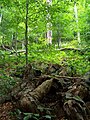 Forest in Stuzica
 -
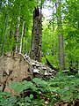
 Havešová
 -
 Stužica
 -
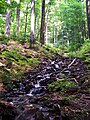 Freshwater stream in Stužica
 -
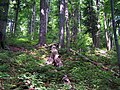 Stužica


References
External links
- "Primeval Beech Forests of the Carpathians". UNESCO World Heritage Centre. Retrieved 28 September 2008.
- Beauty and changes of Primeval beech forests throughout a year
 | ||
1 with Austria, Belgium, Bosnia and Herzegovina, Croatia, Czech Republic, France, Germany, Italy, North Macedonia, Poland, Romania, Slovakia, Slovenia, Spain, Switzerland and Ukraine 2 This is the extension of the site that has been inscribed in North Macedonia since 1979. The area around the town of Pogradec at the shores of Lake Ohrid was inhabited by the Illyrians in the 5th century BC, followed by the Romans and the Slavs. Traces of the Roman road Via Egnatia are evidence of an important passage route in the region. The ruins of the paleo-christian church of Lin together with its floor mosaics reveal the presence of Christianity. The historical centre of Pogradec represents an example of 19th to 20th century Albanian vernacular architecture. | ||

|   | |
1 Listing shared with six other countries, which includes Belgium's Maison Guiette; 2 Listing shared with France; 3 Listing shared with the Netherlands, which includes Belgium's Wortel; 4 Listing shared with France 5 Listing shared with seven other countries, which includes Belgium's Spa; 6 Listing shared with seventeen other countries, which includes Belgium's Sonian Forest. | ||
 | ||
1 with Albania, Austria, Belgium, Bosnia and Herzegovina, Croatia, Czech Republic, France, Germany, Italy, North Macedonia, Poland, Romania, Slovakia, Slovenia, Spain, Switzerland and Ukraine | ||
|  | |
| ||
| Cultural |
| |
|---|---|---|
| Natural | ||
| ||
| Cultural | ||
|---|---|---|
| Natural | ||

| Cultural |
|  |
|---|---|---|
| Natural | ||
- World Heritage Sites in Bulgaria
- Use dmy dates from October 2010
- Protected areas of the Eastern Carpathians
- Temperate broadleaf and mixed forests
- Ecoregions of Europe
- World Heritage Sites in Albania
- World Heritage Sites in Austria
- World Heritage Sites in Belgium
- World Heritage Sites in Croatia
- World Heritage Sites in Germany
- World Heritage Sites in Italy
- World Heritage Sites in Romania
- World Heritage Sites in Slovakia
- World Heritage Sites in Slovenia
- World Heritage Sites in Spain
- World Heritage Sites in Ukraine
- Flora of Ukraine
- Flora of Slovakia
- Old growth forests
- Transboundary protected areas