Robinson Township, Posey County, Indiana
(Redirected from Robinson Township, Indiana)
Robinson Township | |
|---|---|
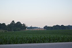
 State Road 66 southeast of Blairsville | |
 | |
| Coordinates: 38°03′01″N 87°45′03″W / 38.05028°N 87.75083°W | |
| Country | United States |
| State | Indiana |
| County | Posey |
| Government | |
| • Type | Indiana township |
| Area | |
| • Total | 39.14 sq mi (101.37 km2) |
| • Land | 39.13 sq mi (101.34 km2) |
| • Water | 0.01 sq mi (0.04 km2) |
| Elevation | 459 ft (140 m) |
| Population (2020) | |
| • Total | 3,855 |
| • Density | 98/sq mi (38/km2) |
| FIPS code | 18-65124[2] |
| GNIS feature ID | 453806 |
Robinson Township is one of ten townships in Posey County, Indiana. As of the 2020 census, its population was 3,855.[3]
Robinson Township was named at an unknown date for Jonathan Robinson, an early settler.[4]
| Census | Pop. | Note | %± |
|---|---|---|---|
| 1890 | 1,638 | — | |
| 1900 | 1,641 | 0.2% | |
| 1910 | 1,502 | −8.5% | |
| 1920 | 1,307 | −13.0% | |
| 1930 | 1,162 | −11.1% | |
| 1940 | 1,198 | 3.1% | |
| 1950 | 1,360 | 13.5% | |
| 1960 | 1,544 | 13.5% | |
| 1970 | 2,218 | 43.7% | |
| 1980 | 3,750 | 69.1% | |
| 1990 | 3,863 | 3.0% | |
| 2000 | 3,976 | 2.9% | |
| 2010 | 3,942 | −0.9% | |
| 2020 | 3,855 | −2.2% | |
| Source: US Decennial Census[5] | |||
Unincorporated places
[edit]Education
[edit]It is within the Metropolitan School District of North Posey County,[6] which operates North Posey High School.
References
[edit]- ^ "US Board on Geographic Names". United States Geological Survey. October 25, 2007. Retrieved January 31, 2008.
- ^ "U.S. Census website". United States Census Bureau. Retrieved January 31, 2008.
- ^ "Explore Census Data". data.census.gov. Retrieved April 9, 2024.
- ^ Leffel, John C. (1913). History of Posey County, Indiana. Standard Publishing Company. p. 82.
- ^ "Township Census Counts: STATS Indiana".
- ^ "2020 CENSUS - SCHOOL DISTRICT REFERENCE MAP: Posey County, IN" (PDF). U.S. Census Bureau. Retrieved June 11, 2024. - Text list
External links
[edit]
