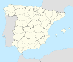
Olmedo, Valladolid
(Redirected from Olmedo, Spain)
Olmedo | |
|---|---|
| Olmedo | |
 | |
| Coordinates: 41°17′20″N 4°41′00″W / 41.28889°N 4.68333°W | |
| Country | |
| Autonomous community | |
| Province | |
| Comarca | |
| Government | |
| • Alcalde | Alfonso Ángel Centeno Trigos (PP) |
| Area | |
| • Total | 129.38 km2 (49.95 sq mi) |
| Elevation | 740 m (2,430 ft) |
| Population (2018)[1] | |
| • Total | 3,654 |
| • Density | 28/km2 (73/sq mi) |
| Time zone | UTC+1 (CET) |
| • Summer (DST) | UTC+2 (CEST) |
| Postal code | 47410 |
| Official language(s) | Spanish |
| Website | www.olmedo.es |
Olmedo is a municipality in the province of Valladolid, Spain. The Mudéjar theme park is located here.[2]
History
[edit]Historically, there was a Jewish community in Olmedo in the Middle Ages, up until the 1492 expulsion of the Jews.[3]
Museums
[edit]- Palacio Caballero de Olmedo.
- Parque temático del Mudéjar de Castilla y León.
Transport
[edit]Olmedo is on the N-601 road (Adanero-Olmedo-Valladolid–Medina de Rioseco–León).
The Madrid–Valladolid high-speed rail line runs through the municipality, and Olmedo is planned to be the branching point for the high-speed line running to Zamora and Galicia.
Olmedo is at one end of a 14.4km test track for high speed trains, and the Talgo gauge changer system. Medina del Campo is at the other end.
Gastronomy
[edit]Notable people
[edit]- Juan de Sarmiento, member of the Council of the Orders and historian of the Order of Alcántara;
- Ignacio Ortega y Cortés, member of the Council of the Orders and assistant to Diego de Covarrubias.
- Sebastián Cortés y Cárcel, jurist;
- Brother Bartolomé Ochaita, advisor to Hernán Cortés;
- Alonso de Zuazo (1466–1539), judge and governor of New Spain;
- Juan Jiménez de Montalvo (1551–?), judge of the Royal Audiencia of Lima (1598–?) and acting Viceroy of Peru (1621–22);
- Jerónimo de Alderete (1516–56), conqueror of Chile;
- Julio Valdeón Baruque (1936–2009), historian;
- José Antonio González Caviedes (1938–1996), mayor of Olmedo and Senator for the UPD and later for the Popular Party
- Miriam González Durántez (1968–), lawyer, wife of Nick Clegg (Deputy Prime Minister of the United Kingdom 2010–15), daughter of José Antonio González Caviedes.
References
[edit]- ^ Municipal Register of Spain 2018. National Statistics Institute.
- ^ "Reportaje | Gulliver, en la vieja Castilla". El País (in Spanish). 2004-04-30. ISSN 1134-6582. Retrieved 2018-03-22.
- ^ "Olmedo". Jewish Virtual Library. Retrieved 1 July 2024.
External links
[edit]Wikimedia Commons has media related to Olmedo.


