This is a file from the Wikimedia Commons

File:Mars Orbiter Laser Altimeter (MOLA) Globe.jpg

From Wikipedia, the free encyclopedia
Jump to navigation Jump to search

Original file(11,649 × 5,723 pixels, file size: 10.49 MB, MIME type: image/jpeg)

Warning The original file is very high-resolution. It might not load properly or could cause your browser to freeze when opened at full size. Open in ZoomViewer

Summary

Description
Ελληνικά: Τοπογραφικός χάρτης του πλανήτη Άρη σύμφωνα με τα δεδομένα που συγκεντρώθηκαν από το πείραμα MOLA (Mars Orbiter Laser Altimeter) της διαστημοσυσκευής Mars Global Surveyor της NASA. Ο χάρτης είναι έτσι φτιαγμένος έτσι ώστε να επιτρέπει την κατασκευή μιας τοπογραφικής σφαίρας του πλανήτη, ανάλογης μιας υδρόγειου σφαίρας της Γης. Το βόρειο ημισφαίριο είναι αριστερά και το νότιο δεξιά.
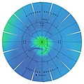
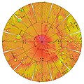
English: The color shaded relief image used as the base for this globe has a resolution of 32 pixels per degree (approximately 1850 m/pixel), and was produced and supplied by the MOLA Science Team (http://ltpwww.gsfc.nasa.gov/tharsis/mola.html). The image is shaded as if illuminated everywhere from the west. The elevations represented in color are with respect to a gravitational equipotential surface whose mean equatorial radius is that of the topography. The Astrogeology Team of the U.S. Geological Survey reprojected the image into the format displayed above. The images are presented in a projection that portrays the entire surface of Mars in a manner suitable for the production of a globe; the number, size, and placement of text annotations were chosen for a 12-inch globe. Prominent features are labeled with names approved by the International Astronomical Union. A specialized program was used to create the "flower petal" appearance of the images; the area of each petal from 0 to 75 degrees latitude is in the Transverse Mercator projection, and the area from 75 to 90 degrees latitude is in the Lambert Azimuthal Equal-Area projection. The northern hemisphere of Mars is shown on the left, and the southern hemisphere on the right.
Date
Source http://photojournal.jpl.nasa.gov/catalog/PIA02993 file
Author NASA/JPL/USGS
Other versions
color elevation key
This image or video was catalogued by Jet Propulsion Laboratory of the United States National Aeronautics and Space Administration (NASA) under Photo ID: PIA-02993.

This tag does not indicate the copyright status of the attached work. A normal copyright tag is still required. See Commons:Licensing.
Other languages:
Public domain This file is in the public domain in the United States because it was solely created by NASA. NASA copyright policy states that "NASA material is not protected by copyright unless noted". (See Template:PD-USGov, NASA copyright policy page or JPL Image Use Policy.)
Warnings:

Captions

Add a one-line explanation of what this file represents

Items portrayed in this file

depicts

10 November 2000

File history

Click on a date/time to view the file as it appeared at that time.

Date/TimeThumbnailDimensionsUserComment
current17:17, 25 September 2011Thumbnail for version as of 17:17, 25 September 201111,649 × 5,723 (10.49 MB)Badseed{{LargeImage}} == {{int:filedesc}} == {{Information |Description={{el|Τοπογραφικός χάρτης του πλανήτη Άρη σύμφωνα με τα δεδομένα που συγκεντρώθηκαν από το πείραμα MOLA (Mars Or
No pages on the English Wikipedia use this file (pages on other projects are not listed).

Global file usage

The following other wikis use this file:

  • Usage on fr.wikipedia.org

Metadata